


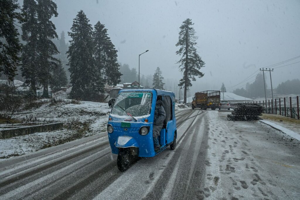
Srinagar- After Chilla-i-Kalan– the 40-day harshest winter period– ended on a dry note in Kashmir, the 20-day small cold known as “Chillai Khurd” too failed to bring any major respite.
However, as the 20-day small cold is all set to culminate on (Wednesday February 19), the weatherman has predicted light to moderate rain and snow at many places on its last day.
The fresh rains and snow in Jammu and Kashmir will likely end the prolonged dry spell tomorrow as a two-day wet spell is expected to bring rains and snow in J&K till Thursday.
Notably, after a 20-day long Chillai-Khurd that occurs between January 31 and February 19, a 10-day long Chillai-Bachha will commence from February 20 to March 2.
Director Meteorological (MeT), Dr Mukhtar Ahmad said there is a possibility of light to moderate rain and snow at many places during 19th evening to 20th late afternoon. “The fresh Western Disturbance is all set to hit the Union Territory,” he added.
Dr Ahmad said that the plains of Kashmir & Jammu may receive light to moderate rain and thunder with gusty winds at few places, adding that the higher reaches of Chenab Valley & South Kashmir may receive moderate snowfall up to around 10 inches while the higher reaches of north & Central Kashmir may receive snowfall up to 8 inches.
Meanwhile, an Independent Weather Forecaster, Faizan Arif Keng said that a fresh Western Disturbance is set to develop over Afghanistan on February 19 and quickly move towards Jammu and Kashmir by February 20, bringing widespread rain and snow across the Union Territory.
“The first signs of the disturbance will be felt in the higher reaches from late night on February 19, with precipitation gradually intensifying as it spreads across the region. Most parts of Jammu and Kashmir are likely to witness a moderate spell of rain/snow, along with the possibility of a heavy spell in some parts,” he said.
“Overall, on average, Jammu region may record higher precipitation than Kashmir Valley. The Chenab Valley districts – Ramban, Kishtwar, and Doda – are also expected to receive moderate to heavy precipitation. In Kashmir Valley plains, rains may dominate on that day, but a sharp drop in temperature could trigger a transition to snowfall, especially under prolonged heavy precipitation,” Keng added.
Temperatures, which will remain in the range of 15 – 18°C on February 19, are expected to drop below 7°C on February 20. The Pir Panjal range is expected to receive heavy snowfall, affecting areas such as Gulmarg, Sinthan Top, Peer Ki Gali, and other parts of Mughal Road, Keng added.
Due to higher temperatures, lightning and thundershowers may remain a common feature on that day, especially in Jammu region. There is a risk of shooting stones/landslides on Jammu-Srinagar National Highway on 20th February. Weather is expected to improve from 21st February onward,” he said. (KNO)
Follow this link to join our WhatsApp group: Join Now
Be Part of Quality Journalism |
Quality journalism takes a lot of time, money and hard work to produce and despite all the hardships we still do it. Our reporters and editors are working overtime in Kashmir and beyond to cover what you care about, break big stories, and expose injustices that can change lives. Today more people are reading Kashmir Observer than ever, but only a handful are paying while advertising revenues are falling fast. |
| ACT NOW |
| MONTHLY | Rs 100 |  |
| YEARLY | Rs 1000 | |
| LIFETIME | Rs 10000 | |


