Srinagar- For those looking forward to a snowy start to 2024 in Jammu & Kashmir, January was an even bigger disappointment compared to December 2023. ‘Chillai kalan’ — the 40-day-long period of bitter cold — also failed to deliver any precipitation. Lack of snow and rain left the residents freezing amid the dry cold spell, while the tourists turned back home in dismay from the snowless ski resorts.
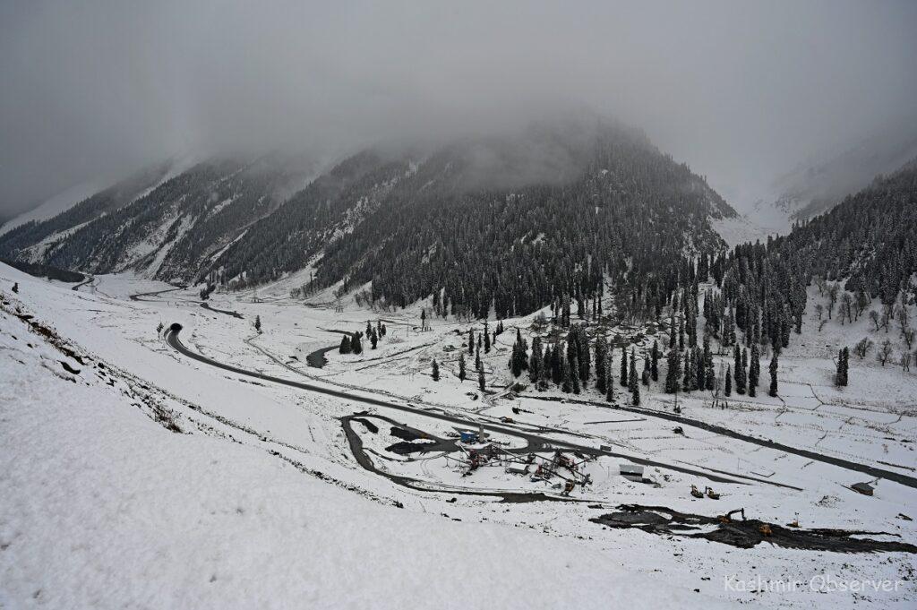
And just as hope turned to hopelessness, a series of strong Western Disturbances, as if held back by some invisible force, began rushing in since the weekend. Fresh bouts of snow reportedly graced places like Gulmarg, Sonmarg, Gurez, Keran, Tangdhar, among others. In fact, tourists were seen frolicking in the snow at Gulmarg’s ski resort on Sunday, January 28.
Now, two more successive systems will be impacting Northwest India from January 30 and February 3, respectively. According to the India Meteorological Department (IMD), these western disturbances will spark up to moderate, fairly widespread rainfall/snowfall over Jammu & Kashmir, Ladakh, Gilgit, Baltistan, Muzaffarabad and Himachal Pradesh during the next seven days, until February 4.
Further, isolated heavy showers or snowfall (64.5 mm-115.5 mm) is also likely over Kashmir on Tuesday and Wednesday, January 30-31, and Himachal Pradesh on Wednesday, January 31.
A yellow watch, meaning ‘be prepared’, has been issued over these regions for the forecast period owing to the possibility of intense snowfall activity.
Roads in higher reaches and important passes, like the Sinthan Pass, Mughal Road, Sadhna and Razdan Pass and Zojila, have been temporarily closed off amid inclement weather. And travellers have been asked to plan their trips accordingly. The MeT department has also advised farmers to withhold irrigation and fertiliser application and drain out excess water from orchards and fields during this period.
As for the mercury levels, the cloud cover over the region has caused the night temperatures to soar across Kashmir. Srinagar witnessed its warmest night of the Chillai-Kalan as it recorded a low of 3.3°C against the -2.3°C from the previous night. Daytime mercury levels, however, will drop due to the precipitation activity.
While one might argue that this much-needed change in temperatures and snowfall activity might have come too late, it remains to be seen what impact it’ll have on the region’s overall seasonal stats.
For now, Jammu, Kashmir, Ladakh, and Himachal have recorded almost zero rainfall between January 1 and 28, leaving them with a massive deficit of 99%.
Meanwhile, the cloudy skies in the plains over the last few days have pushed the minimum temperatures above the freezing point in most parts of Kashmir.
Srinagar city recorded a low of 3.6 degrees Celsius.
Pahalgam recorded a minimum temperature of minus 0.7 degrees Celsius, Qazigund 2.0 degrees Celsius, Kokernag 0.5 degrees Celsius and Kupwara 1.7 degrees Celsius.
Gulmarg registered a low of minus 3.2 degrees Celsius and was the only place in the valley that registered sub-zero night temperature.
Follow this link to join our WhatsApp group: Join Now
Be Part of Quality Journalism |
Quality journalism takes a lot of time, money and hard work to produce and despite all the hardships we still do it. Our reporters and editors are working overtime in Kashmir and beyond to cover what you care about, break big stories, and expose injustices that can change lives. Today more people are reading Kashmir Observer than ever, but only a handful are paying while advertising revenues are falling fast. |
| ACT NOW |
| MONTHLY | Rs 100 | |
| YEARLY | Rs 1000 | |
| LIFETIME | Rs 10000 | |


